We often underplay the significance of rivers and water bodies to human health and the overall environment, but the truth is far from it.
The imperative of monitoring water quality parameters looms large in the realm of effective management and conservation initiatives. In line with UNESCO’s sobering statistic which reveals that “90% of sewage in developing nations is discharged untreated directly into water bodies,” it is unsettling to recognize that each day ushers in a staggering two million tons of sewage and other deleterious effluents into the world’s water, not to mention the annual industrial contribution of an estimated 300-400 megatons of waste into these aquatic realms.
The lamentable proliferation of water pollutants, from industrial waste and oil contamination to plastic proliferation, pesticide and fertilizer runoff, and radioactive contamination, is accelerating at an alarming pace. This alarming trend exacerbates the already dire state of freshwater resources. Traditionally, the monitoring of water quality has been reliant upon the laborious processes of manual sampling and meticulous laboratory analyses. These methods, aside from being time-consuming and expensive, often fall short in terms of spatial coverage. Recently a growth in remote sensing technologies has led a transformative era in the surveillance of river water quality.
Remote sensing, by definition, entails the acquisition of information pertaining to an object or phenomenon without the need for direct physical contact. In the context of water quality monitoring, remote sensing has proven instrumental in amassing invaluable data regarding various parameters, including temperature, turbidity, chlorophyll-a concentration, dissolved oxygen levels, and suspended sediment density. Notably, this data collection process can be executed across vast geographical expanses, thus providing a comprehensive, real-time panorama of water quality dynamics within river ecosystems. Below, we delve into the key developments within remote sensing technologies and their manifold applications for the monitoring of river water quality.
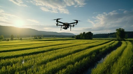
Hyperspectral Imaging via Unmanned Aerial Vehicles (UAVs): Hyperspectral imaging represents a technological marvel, capable of capturing high-resolution images across an extensive swath of the electromagnetic spectrum. Its utility lies in the identification and characterization of water constituents, driven by their distinctive spectral fingerprints. By scrutinizing the reflected light emanating from water bodies, researchers can glean indispensable insights into water quality parameters such as chlorophyll-a concentration, turbidity, dissolved organic matter, and the proliferation of algal blooms. Importantly, hyperspectral imaging can be implemented from both airborne and satellite platforms, ensuring comprehensive coverage and real-time monitoring capabilities.
LiDAR (Light Detection and Ranging) Technology: LiDAR relies upon laser pulses to measure the precise distance between a sensor and the water’s surface. This innovative approach enables the creation of meticulously detailed elevation maps encompassing rivers and their adjacent landscapes. By fusing LiDAR data with water quality parameters such as temperature, conductivity, and nutrient concentrations, researchers are empowered to garner profound insights into the spatial distribution of pollutants and their adverse repercussions on river ecosystems. Furthermore, LiDAR facilitates the identification of riverbank erosion, a phenomenon that significantly contributes to sediment and nutrient loading and the concomitant deterioration of water quality.
Sensorization: In the realm of river water quality assessment, electronic sensors are veritable linchpins. These sophisticated devices are employed to measure a wide spectrum of physical properties, ranging from temperature and pH levels to conductivity, turbidity, and dissolved oxygen levels. They provide precise, real-time data regarding various parameters. The integration of wide-area wireless communication technology interfaces, such as NB-IoT, LoRA, and Sigfox, has enabled the implementation of remote monitoring solutions. These solutions expedite the assessment of temperature, pH levels, conductivity, turbidity, dissolved oxygen levels, and more in real-time, thereby bolstering the effectiveness of monitoring efforts.
Application of Remote Sensing Technologies for Precise Water Quality Assessment
Historically, the utilization of containers in small-footprint, long-life cycle embedded systems within the operational technology (OT) sphere has been rather limited. Embedded devices, often found in industrial, medical, and automotive systems, typically demand lightweight, dependable software characterized by extended life cycles. Regrettably, existing container technologies and platforms, as prevalent in enterprise Linux, are often either bloated or necessitate excessively frequent updates to operate optimally within these embedded systems.
Integration of Remote Sensing with Water Quality Models: The fusion of remote sensing data with water quality models has significantly bolstered our ability to comprehend and anticipate fluctuations in river water quality. By assimilating remote sensing data into hydrodynamic and water quality models, scientists are poised to elevate the precision of water quality forecasts. This approach facilitates the assessment of the influence wielded by various sources of pollution and management practices. In totality, this integrated framework engenders more streamlined monitoring, evaluation, and the implementation of water resource management strategies.
Water Quality Mapping Utilizing Hyperspectral Imaging: The potency of remote sensing technologies extends to the creation of meticulous spatial maps encompassing a plethora of water quality parameters, spanning turbidity, chlorophyll-a concentration, ammoniacal nitrogen, reactive phosphorus, total suspended solids, and beyond. These comprehensive maps offer a panoramic view of water quality across expansive areas. This holistic perspective proves invaluable in pinpointing pollution sources, assessing their ramifications, and guiding remedial strategies. Moreover, remote sensing is adept at detecting and monitoring the presence of detrimental substances such as oil spills, chemical pollutants, and heavy metals in water bodies. The employment of hyperspectral and multispectral sensors enables the identification of distinctive spectral markers associated with these substances, thereby facilitating early detection and prompt responses.
Real-time Sensors: The deployment of real-time sensors, encompassing conductivity sensors, pH sensors, dissolved oxygen (DO) sensors, turbidity sensors, online spectrophotometers, and similar apparatus, plays a pivotal role in ensuring the timely and accurate evaluation of water conditions. These sensors engage in continuous measurement across various parameters, providing immediate feedback and thereby permitting swift interventions and proactive management strategies. Real-time sensors can be seamlessly integrated into monitoring networks or stationed as standalone devices at strategically vital monitoring points. Subsequently, the data collected is typically transmitted wirelessly to central systems for exhaustive analysis and visualization, ensuring the prompt detection of water quality aberrations and expediting the process of decision-making and effective management.
Remote Sensing for the Detection of Harmful Algal Blooms (HABs): Harmful algal blooms (HABs) represent an ominous menace to water quality and public health. Remote sensing technologies have emerged as invaluable assets in the battle against HABs within river ecosystems.
Satellite-based sensors are adept at discerning alterations in water colour and chlorophyll-a concentrations, serving as reliable indicators of harmful algae’s presence.
Additionally, the implementation of advanced algorithms and machine learning techniques has enabled the distinction between various algal species and the estimation of toxin concentrations. These capabilities empower early detection and timely responses to HAB events, thus mitigating potential hazards to both the environment and human health. Notably, a ground-breaking project named “Aquawater Australia” has been introduced on a national scale. This pioneering endeavour leverages data from satellites and ground-based sensors to furnish early warnings regarding potential events such as algal blooms, blackwater occurrences, and runoff contamination, solidifying its status as a global trailblazer in water quality forecasting.
The relentless advancement of remote sensing technologies has ushered in a paradigm shift within the domain of river water quality monitoring. Hyperspectral imaging, LiDAR, UAVs, and satellite-based sensors have collectively enriched our understanding of water quality parameters, affording real-time monitoring capabilities, early detection of pollutants, and smart decision-making processes.
The integration of remote sensing with water quality models represents a watershed moment in our ability to gauge and anticipate water quality dynamics. These technological advancements have translated into more efficient and effective water resource management strategies, thereby safeguarding the vitality and sustainability of river ecosystems and the communities reliant upon them. With the relentless evolution of remote sensing technologies, we can certainly expect an even brighter future marked by further improvements in monitoring capabilities. It’s our turn to watch out for the emergence of more robust, comprehensive water quality assessment tools.
About the author
Ilango Ganesan leads Technology solutions for Electric, Gas and Water Utility industry clients at Cyient. He holds Masters in Software Systems from BITS. He has vast experience in IT / OT integration, Network analytics and Data governance framework in Utility segment. He has more than 30 years’ experience in end-to-end development of intelligent products, complex systems and enterprise wide solutions for Utility, Energy & Automotive specific client needs.


