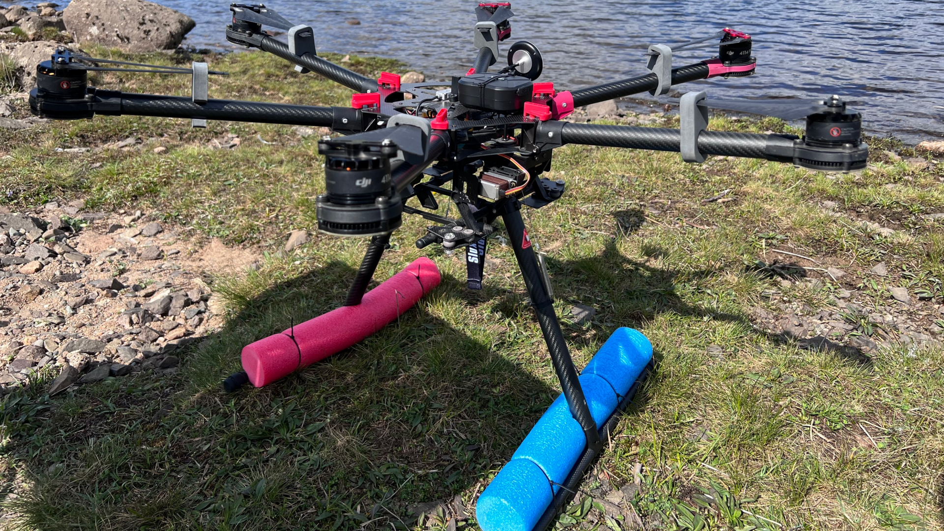
The latest Big Windermere survey was given a high-tech boost thanks to innovative autonomous vehicle technology.
The survey is one of the largest ongoing citizen science projects in the UK and involves 100 volunteers taking samples at various points around the lake and its tributaries. It is conducted independently by Lancaster University and the Freshwater Biological Association as part of the Love Windermere partnership.
And this time, drone technology was used to collect samples from areas that had previously been inaccessible.
The drones are the brain-child of Dale Colley from Scottish-based Altitude Thinking.
Dale explained: “This is exactly the kind of challenge that Altitude Thinking was developed for – using technology to access inaccessible or difficult to reach locations. To date, we have focused on collecting water samples from anywhere in reservoirs that will provide information on water quality. In addition to this, we are also developing other remotely operated vehicles, whether that be an aerial, surface or submersible to collect samples from any body of water.”
Altitude Thinking is one of the companies to be trialled through United Utilities highly regarded Innovation Lab.
Samples from the second survey are now being analysed independently by scientists at Lancaster University and other independent laboratories for concentrations of bacteria and nutrients such as nitrogen and phosphorus, which can cause issues for both ecological and human health.
The research and data gathered by the Big Windermere Survey throughout the seasons will be used to develop evidence-based plans to maintain and improve the lake for future generations, including by the Love Windermere Partnership.
Dr Louise Lavictoire, Head of Science from the Freshwater Biological Association, explained:
“The Freshwater Biological Association has been monitoring water quality periodically here on the shores of Windermere for more than 90 years.
“It’s really important that we build up a seasonal picture of water quality, taking into account variable factors such as rainfall, temperature and visitor numbers. Ultimately this will allow us to see where there are specific problems affecting the lake, and then we can collectively plan the right interventions to tackle these issues.”
United Utilities Wastewater Catchment Manager for Cumbria, Sion Platts-Kilburn, added:
“As members of the Love Windermere partnership, we are working alongside the Freshwater Biological Association and others to develop evidence-based, long-term plans to maintain and improve water quality in the lake.
“When we realised we had access to technology that could make the survey even bigger by opening up spots that can’t be safely accessed by volunteers, it made perfect sense to put it to the test.
“Not only does this help to increase the level of sampling in the survey, it also gave Altitude Thinking a great opportunity to test the technology further by using it in different types of locations and conditions.”


